Everest Base Camp Trekking Distance
17th May, 2026
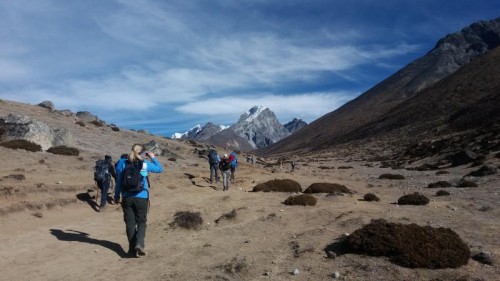
The total Everest Base Camp Trekking distance is approximately 130 to 135 kilometers, including the trek from Lukla to Lukla and side trips around Namche Bazaar, Dingboche, and Kala Patthar. The total distance may vary depending on how many side hikes you choose to do during the trek.
Table of Contents
Below, you will find the day-by-day trekking distance, detailed trekking route, trail information, side trip hiking options, how to reach Lukla, and how to start the trek to Everest Base Camp.
How to Reach Lukla for the 12 Days Everest Base Camp Trek?
To reach Lukla for the 12 days Everest Base Camp Trek, trekkers need to take a flight either from Kathmandu or Ramechhap. During the busy trekking seasons, especially in October, November, and from mid-March to mid-May, many Lukla flights operate from Ramechhap instead of Kathmandu due to heavy air traffic.
Normally, flights from Kathmandu to Lukla operate in the morning if the weather conditions are favorable. Likewise, flights from Ramechhap to Lukla also operate in the morning. Reaching Ramechhap from Kathmandu takes around 3 to 4 hours by private vehicle, depending on road conditions.
The flight duration to Lukla is approximately 25 minutes from Kathmandu and around 15 minutes from Ramechhap. After arriving in Lukla, the Everest Base Camp Trek officially begins.
Lukla to Phakding Distance
The distance from Lukla to Phakding is approximately 8 kilometers (5 miles), and it takes around 3 to 4 hours of trekking. The trail gradually descends from Lukla to Phakding. Lukla is situated at an altitude of 2,800 meters, while Phakding is at 2,655 meters; meaning Phakding is about 145 meters lower than Lukla.
The trekking trail is well maintained and passes through charming villages. Along the way, trekkers can see Mani walls, prayer flags, beautiful hills, and stunning mountain views.
Phakding to Namche Bazaar Distance
Phakding to Namche Bazaar distance is approximately 10 km (6.3 miles) depending on the exact trail variation. Although the distance is relatively short but it typically takes 6 to 7 hours of trekking because of steep elevation gain and rugged Himalayan terrain.
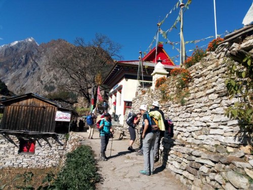
The trail follows the Dudh Koshi River valley, crossing several iconic suspension bridges, including the famous Hillary high bridges. Trekkers pass through villages like Monjo, where the entry checkpoint to Sagarmatha National Park is located, and Jorsalle, the last settlement before the big ascent.
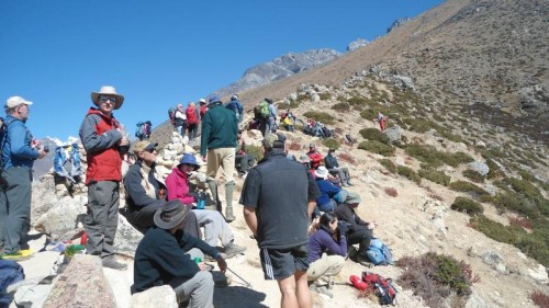
After Jorsalle, the trail becomes significantly steeper as it climbs through pine forests with long uphill switchbacks. The final ascent to Namche Bazaar is the most demanding part, gaining roughly 600–700 meters in elevation in a single climb, which is why many trekkers feel the effects of altitude here for the first time.
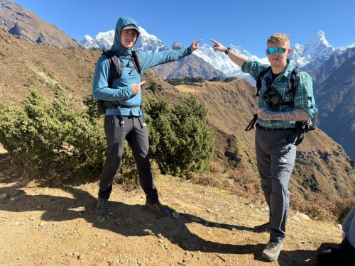
Acclimatization Day at Namche Bazaar and Hike to Everest View Hotel
An acclimatization day at Namche Bazaar is a crucial rest-and-adaptation stop on the Everest trekking route, designed to help trekkers adjust to higher altitudes before moving deeper into the Himalayas.
One of the most popular short hikes on this day is the walk to the Everest View Hotel, which is located above Namche and is famous for its panoramic views of Mount Everest, Lhotse, Ama Dablam, and other Himalayan peaks on clear days.
The hike from Namche Bazaar to the Everest View Hotel (via Syangboche) is approximately 2.5 to 3 km one way, making it about 5 to 6 km round trip. Despite the short distance, it involves a steady uphill climb with an elevation gain of roughly 300 to 400 meters, making it a moderate but very rewarding acclimatization
Namche Bazaar to Tengboche Distance
The distance from Namche Bazaar to Tengboche Monastery is approximately 9.5 (6 miles), and it usually takes around 5 to 6 hours of trekking, depending on pace, weather conditions, and rest stops.
The trail begins with a gradual ascent out of Namche, followed by a relatively easy traverse along the hillside through villages such as Kyangjuma and Sanasa, offering spectacular views of peaks like Ama Dablam, Thamserku, and Everest on clear days. The route then descends steeply to Phunki Tenga, a small settlement by the Imja Khola river, where trekkers often stop for lunch and rest.
After crossing the suspension bridge over the river, the trail becomes a challenging uphill climb through pine and rhododendron forests. This final ascent is the most demanding section of the day, gaining significant elevation before reaching Tengboche.
Tengboche to Dingboche Distance
The distance from Tengboche to Dingboche is approximately 11 km (6.9 miles), and it usually takes around 5 to 7 hours of trekking, depending on walking pace, weather conditions, and rest stops along the way.
The trail begins with a steep descent from Tengboche into a forested section leading down toward the Imja Khola valley. After crossing the river and passing through small settlements such as Debuche, Pangboche, and Shomare, the route gradually transitions from lush vegetation to a more open alpine landscape as altitude increases.
Pangboche is one of the most notable villages on this route, offering traditional Sherpa culture and one of the oldest monasteries in the region. From here, the trail continues with a steady uphill climb toward Dingboche, becoming more exposed and windier as trekkers gain elevation.
Dingboche situated at around 4,410 meters (14,470 ft), making it an important acclimatization stop on the way to Everest Base Camp.
Acclimatization Day at Dingboche and Hike to Nangkartshang (Ngagarkhang) Hill
An acclimatization day at Dingboche is an essential part of the Everest Base Camp trekking journey, allowing trekkers to adapt to the increasing altitude before continuing toward higher elevations. At an altitude of around 4,410 meters (14,470 ft), Dingboche serves as a key acclimatization stop in the upper Khumbu region.
One of the most popular acclimatization hikes from Dingboche is the climb to Nangkartshang Hill (also spelled Ngagarkhang Hill), a spectacular viewpoint known for its panoramic Himalayan scenery. The hike offers breathtaking views of peaks such as Ama Dablam, Makalu, Lhotse, Island Peak, and surrounding mountain ranges.
The distance from Dingboche to Nangkartshang Hill is approximately 3 km one way, making it around 6 km round trip depending on the turnaround point. Although the distance is relatively short, the trail involves a steep and continuous uphill ascent with an elevation gain of roughly 600 to 700 meters.
Dingboche to Lobuche Distance
The distance from Dingboche to Lobuche is approximately 9 km ( 5.5 miles), and it usually takes around 5 to 7 hours of trekking, depending on pace, weather conditions, and acclimatization.
The trail begins with a gradual ascent through open alpine terrain above the Khumbu valley, offering impressive views of peaks such as Taboche, Cholatse, Lobuche Peak, and Ama Dablam. Trekkers pass through the small settlement of Dughla (Thukla), where many stop for lunch before beginning the steep climb ahead.
After crossing a suspension bridge and the glacial stream near Dughla, the route ascends sharply up the Thukla Pass memorial area, a moving section of the trail marked by stone memorials dedicated to climbers and Sherpas who lost their lives on Everest expeditions. This uphill section is physically demanding due to both the steep gradient and the increasing altitude.
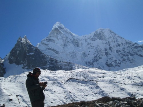
Beyond the memorial ridge, the trail becomes more gradual as it follows the edge of the Khumbu Glacier toward Lobuche. The landscape here is rocky, barren, and windswept, reflecting the harsh beauty of the high Himalayas.
Lobuche situated at an altitude of approximately 4,940 meters (16,210 ft) and serves as the final overnight stop before reaching Everest Base Camp.
Lobuche to Gorakshep Distance
The distance from Lobuche to Gorakshep is approximately 6 km (3.7 miles), and it usually takes around 3 to 4 hours of trekking, depending on weather conditions, trail conditions, and individual acclimatization.
The trail gradually ascends alongside the lateral moraine of the Khumbu Glacier, crossing rocky paths, uneven terrain, and sections of loose stones. Although the distance is relatively short, the high altitude and thin air make the trek physically challenging, requiring a slow and steady pace.
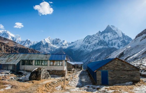
Along the route, trekkers are rewarded with spectacular views of surrounding Himalayan peaks, glacial landscapes, and the dramatic terrain of the upper Khumbu region. The trail involves several short uphill and downhill sections before finally reaching Gorakshep, the last settlement on the Everest Base Camp route, which is situated at an altitude of approximately 5,180 meters (16,942 ft) and serves as the base for hikes to Everest Base Camp and Kala Patthar.
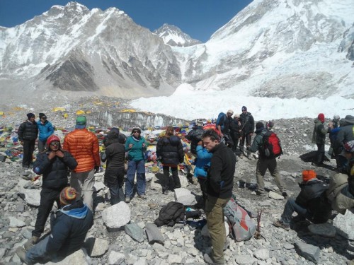
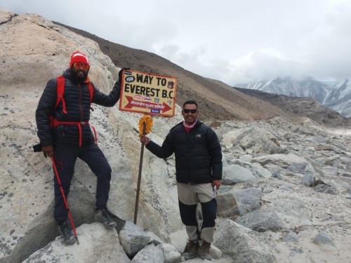
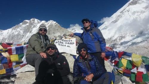
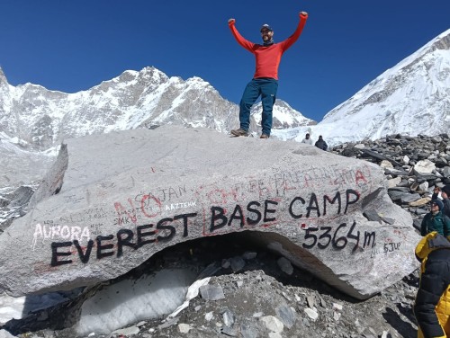
Gorakshep to Everest Base Camp Distance
The distance from Gorakshep to Everest Base Camp is approximately 3.5 (2.5 miles) one way, making it around 7 to 8 km round trip. The hike usually takes about 2 to 3 hours each way, depending on altitude, trail conditions, and individual fitness.
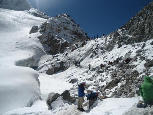
The trail follows the rocky edge of the Khumbu Glacier, passing through uneven moraine paths, loose stones, and icy sections. Although there are no major steep climbs, the extreme altitude above 5,000 meters makes even gradual walking physically demanding, requiring frequent breaks and a slow pace.
Trekkers are surrounded by dramatic Himalayan scenery, including towering ice formations, glacial landscapes, and panoramic views of peaks such as Nuptse, Pumori, and Khumbutse. During the spring climbing season, colorful expedition tents can often be seen at Everest Base Camp, adding to the unique atmosphere of the area.
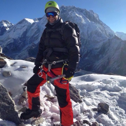
Everest Base Camp itself sits at an altitude of approximately 5,364 meters (17,598 ft), reaching this place is considered a major achievement for trekkers from around the world.
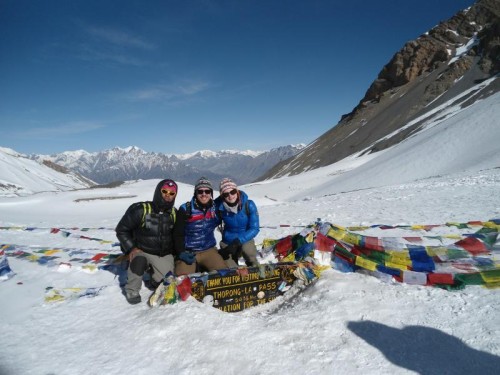
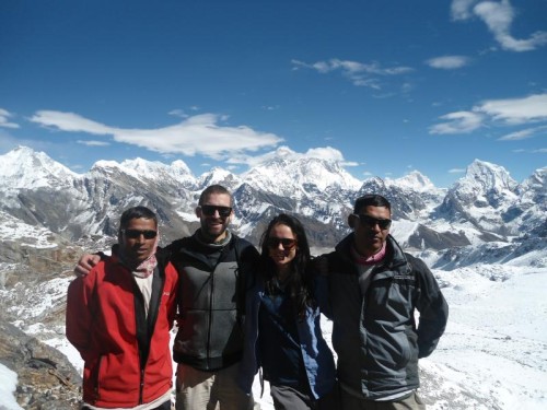
Gorakshep to Kalapathar Distance
The distance from Gorakshep to Kala Patthar is approximately 2 km one way, making it around 4 km round trip. Although the distance is short, the hike is physically demanding due to the steep uphill trail and extreme altitude.
The route gradually climbs over rocky and uneven terrain above Gorakshep, with a continuous ascent that becomes more challenging as trekkers gain elevation. The hike usually takes around 2 to 3 hours round trip, depending on weather conditions, fitness level, and acclimatization.
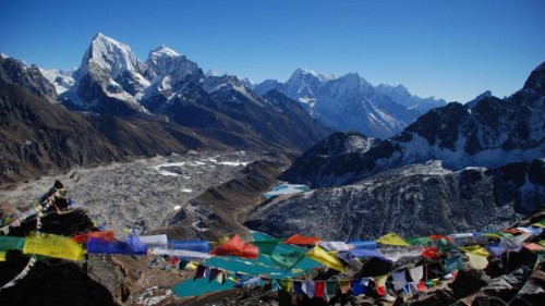
Kala Patthar sits at an altitude of approximately 5,545 meters (18,192 ft) and is widely considered the best viewpoint in the Everest region. From the summit, trekkers can enjoy breathtaking panoramic views of Mount Everest, Nuptse, Pumori, Lingtren, and the Khumbu Glacier, especially during sunrise and sunset when the mountains glow with changing colors.
Gorekshep to Lukla Distance
The total distance from Gorakshep to Lukla is approximately 45 kilometers (28 miles). Most trekkers complete this return journey over 3 to 4 days, depending on itinerary, pace, and weather conditions.
The trail retraces the classic Everest Base Camp route, passing through major settlements such as Lobuche, Pheriche, Tengboche, Namche Bazaar, and Phakding. Along the way, trekkers descend through rocky glacier terrain, alpine valleys, suspension bridges, pine and rhododendron forests, and traditional Sherpa villages.
The route begins with a descent from Gorakshep through the rugged Khumbu Glacier region toward Lobuche and Dingboche or Pheriche. From there, the trail continues downhill through Pangboche and Tengboche, where trekkers can enjoy stunning Himalayan views and visit the famous Tengboche Monastery.
Further along, the trail descends steeply to the Dudh Koshi River before climbing gently back toward Namche Bazaar. After Namche, trekkers continue through Monjo and Phakding, eventually reaching Lukla after crossing several suspension bridges and forested mountain trails.
FAQs about the Everest Base Camp Trek Distance
How far is the Everest Base Camp Trek?
The classic Everest Base Camp Trek is approximately 130–135 kilometers round trip, starting from Lukla and ending back in Lukla. This distance includes acclimatization hikes and side trips to Namche Bazaar, Dingboche, and Kala Patthar. The total distance may vary depending on the itinerary and any additional excursions along the route.
How many kilometers do you need to walk each day during the Everest Base Camp Trek?
During the Everest Base Camp Trek, trekkers typically walk 6 to 18 kilometers (4 to 11 miles) per day. Daily walking distances vary depending on the itinerary and acclimatization schedule. Acclimatization days usually involve shorter hikes, while trekking at higher elevations often covers shorter distances due to the challenging terrain and reduced oxygen levels. On the return journey, longer trekking days are common, particularly on routes such as Gorak Shep to Pheriche, Pheriche to Namche Bazaar, and Namche Bazaar to Lukla. The exact distance walked each day depends on the trekking pace, route, and overnight stops.
How long does the Everest Base Camp Trek take?
A standard Everest Base Camp Trek itinerary typically takes 12 days, including flights between Kathmandu and Lukla, as well as acclimatization days in Namche Bazaar and Dingboche. Some trekkers choose a 13-day Kathmandu-to-Kathmandu itinerary if they prefer a more flexible schedule, additional acclimatization time, or a private trekking arrangement. The total duration may vary depending on the itinerary, trekking pace, and side trips included along the route.
What is the highest point of the Everest Base Camp Trek?
The highest point of the Everest Base Camp Trek is Kala Patthar (5,545 meters / 18,192 feet). While Everest Base Camp sits at 5,364 meters (17,598 feet) and Nangkartshang Peak reaches approximately 5,200 meters (17,060 feet), Kala Patthar is the highest elevation most trekkers reach during the trek. These three locations are popular highlights of the Everest Base Camp journey and are commonly visited for acclimatization, panoramic views, and the overall trekking experience.
Is the Everest Base Camp Trek difficult because of the distance?
The Everest Base Camp Trek is not particularly difficult because of the distance, as the daily walking distances are generally manageable for most fit trekkers. The main challenge comes from the high altitude rather than the distance. As you gain elevation, the air becomes thinner and oxygen levels decrease, making trekking more physically demanding. Proper acclimatization and a steady pace are essential for a safe and enjoyable trek.
What is the total elevation gain during the Everest Base Camp Trek?
The direct elevation difference between Lukla Airport and Everest Base Camp is approximately 2,564 meters. However, due to the numerous ascents and descents along the trail, the total cumulative elevation gain is more than 4,000 meters. The actual elevation gain is significantly higher than the net altitude difference because trekkers repeatedly climb and descend throughout the journey, especially between valleys, rivers, and mountain ridges.
Is there a shorter route (distance) to the Everest Base Camp Trek?
There is no significantly shorter trekking route to Everest Base Camp, as the traditional trek starts from Lukla and returns to Lukla. Some trekkers complete the trek in as little as 10 days by reducing acclimatization time and walking longer distances each day. However, this approach is not generally recommended due to the risk of altitude sickness.
For those looking to shorten the journey, the most common option is to take a helicopter flight from Gorak Shep back to Lukla or Kathmandu after reaching Everest Base Camp. Despite these alternatives, the traditional trekking route remains the most popular way to experience the breathtaking landscapes, Sherpa culture, and natural beauty of Sagarmatha National Park.
How should I prepare for the Everest Base Camp Trekking distance?
To prepare for the Everest Base Camp Trek, you should focus on regular hiking or long walks, stair climbing, cardiovascular training (such as running, cycling, or swimming), leg-strengthening exercises, and multi-day hiking practice while carrying a backpack. It is recommended to begin your training at least two months before the trek. Proper preparation will help you manage the daily walking distances, improve your endurance, and increase your chances of completing the trek comfortably and safely.
Are you interested on any of your travel serveices?
Make Inquiry NowRecent From Blog
15th Jun, 2023
21st Feb, 2021
28th Feb, 2018
5th Sep, 2023

13th May, 2019
19th Feb, 2019

8th Feb, 2021
21st Jan, 2021
29th Jul, 2020
3rd May, 2019
30th Apr, 2020

3rd Apr, 2020
17th Jul, 2020
26th Mar, 2020
31st Mar, 2020
19th Jun, 2023

11th Feb, 2020
11th Mar, 2020
27th Sep, 2019
17th May, 2019
26th Jul, 2020
6th May, 2019

5th Mar, 2019
7th Mar, 2020
18th Feb, 2019

12th Sep, 2019

27th Mar, 2018
27th Mar, 2019
2nd Mar, 2019
16th Jan, 2019

1st Jul, 2023
5th Jul, 2023

5th Jul, 2023

5th Jul, 2023

5th Jul, 2023
5th Dec, 2019
6th Jan, 2019
28th Feb, 2018
9th Dec, 2018
11th Dec, 2018

5th Oct, 2023

3rd Jan, 2024
.jpg)
27th Jan, 2024
29th Jan, 2024
19th Jan, 2025

7th Feb, 2025

17th Feb, 2025
9th Mar, 2025

15th Mar, 2025

18th Mar, 2025

23rd Mar, 2025

25th Mar, 2025

26th Mar, 2025

24th Apr, 2025

21st May, 2025

21st May, 2025

22nd Jun, 2025

22nd Jun, 2025
4th Jul, 2025

14th Jul, 2025

14th Sep, 2025
26th Sep, 2025
20th Dec, 2025
28th Jan, 2026

17th May, 2026
18th May, 2026
2nd Jun, 2026
7th Jun, 2026
9th Jun, 2026
13th Jun, 2026